
Features IcarusRPA
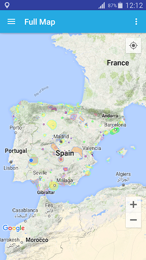
Interactive map where all the aerospace with restrictions to fly a RPAS (UAV) in Spain can be checked.IcarusRPA is a map based tool that shows graphicly the flying restrictions involving RPAs in Spain.
All performance data havce been adapted from the AIP (Aerocraft Information Pbls), which is the basic manual of aerocraft information basic for flying and operatin the RPAs (UAV).
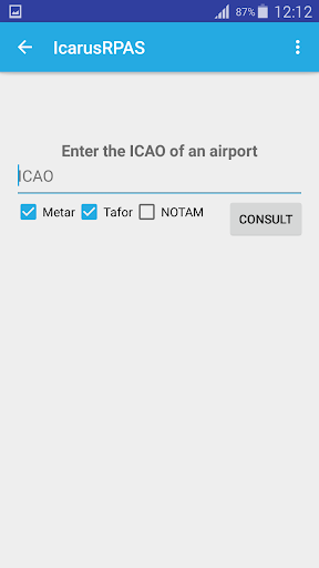
Important information afectting air operations (as Metar or Tafor of any airport -ICAO format-)can be consulted, including the notam of airpots and FIRs.
The tool host different meothorologycal maps showing real-time data of windspeed, clouds and rain and the planetary K-index (Kp), used to measure the magnitude of geomagnetic storms.In this stage of the development of the application, the following information ois shown:- Restricted areas,- Hazardous areas,- Forbidden areas,- Control zoning (CTR),- Fotographic flying restricted areas (ZRVF),- Temporary Segregated areas (TSA),- Other Protected areas,- AeropacesGIS viewer
Weather Features
Get accurate weather forecasts and real-time updates.
Parenting Tools
Track and manage your child's development and daily activities.
Smart Home
Control and monitor your home with smart features.
See the IcarusRPA in Action
Get the App Today
Available for Android 8.0 and above